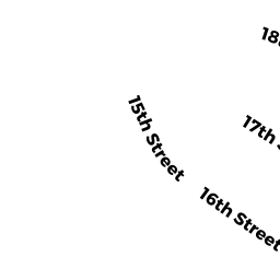
9 SEVENTEENTH ST
Owner Information
BARTON FORREST
PO BOX 609
ONSET, MA 02558


Property Details
9 SEVENTEENTH ST is classified as a Single Family Residential (Bungalow).
The primary structure on this property was built in 1914. There are 2,424ft2 of built area within this property. There is 932ft2 of residential/living space within this property. This property is listed as having 6 rooms.
9 SEVENTEENTH ST is valued at $221,600. The land is valued at $74,000 and the structures are valued at $142,100. There is an additional valuation of $5,500 on this property.
This property is in Zone R30. Confirm with local Zoning Board authorities to ensure there are no overlays or other easements on this property.
The most recent deed for 9 SEVENTEENTH ST is recorded at the local registrar in Book 50163, Page 0266. 9 SEVENTEENTH ST was last sold on Monday, August 13, 2018 for $1.
Assessment data from fiscal year 2022.
Flood Data
According to the FEMA National Flood Hazard Layer, this property does not appear to be in a flood zone. It may also be in an area not yet reviewed. Nonetheless, confirm this information prior to taking any action.
To view the flood hazards around this property, create a FEMA "Firmette" Map of the area around 9 SEVENTEENTH ST.
Broadband Internet Providers
| Provider | Type | Bandwidth (mbps) | |
|---|---|---|---|
| HughesNet | Satellite | 25 | 3 |
| GCI Communication Corp. | Satellite | 0 | 0 |
| Comcast | Cable | 1000 | 35 |
| Verizon New England Inc. | Fiber | 940 | 880 |
| Verizon New England Inc. | DSL | 5 | 0 |
| Viasat Inc | Satellite | 35 | 3 |
| VSAT Systems, LLC. | Satellite | 2 | 1 |
Broadband service provider data from December 2020.
Adjacent Properties
- 52 ELLIS AVE
Undevelopable Residential Land owned by HATHON ADAM TYLER - 7 SEVENTEENTH ST
Single Family Residential owned by HILL ROSALIE P LIFE ESTATE - 0 TERRY LN
Improved, Selectmen or City Council (Municipal) owned by TOWN OF WAREHAM - 0 FONSECA WY
Undevelopable Residential Land owned by CORNERSTONE ESTATES 2